IMD Warns of Heavy Rain, Thunderstorms Across India from Oct 27–31, 2025
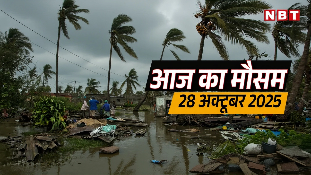
On October 27, 2025, at 2:30 PM IST, the India Meteorological Department issued a critical weather alert spanning five days—October 27 to 31—warning of intense thunderstorms, isolated heavy rainfall, and gusty winds across nearly half the country. From Delhi’s evening drizzle to the torrential downpours expected in Odisha and Vidarbha, the forecast paints a picture of a weather system still lingering after monsoon’s retreat, catching communities off guard. The India Meteorological Department, operating under the Ministry of Earth Sciences, Government of India, stressed that urban and hilly areas are especially vulnerable, urging authorities to act on ORANGE AND RED COLOUR warnings before conditions worsen.
Where the Rain Is Coming—And Where It’s Hitting Hardest
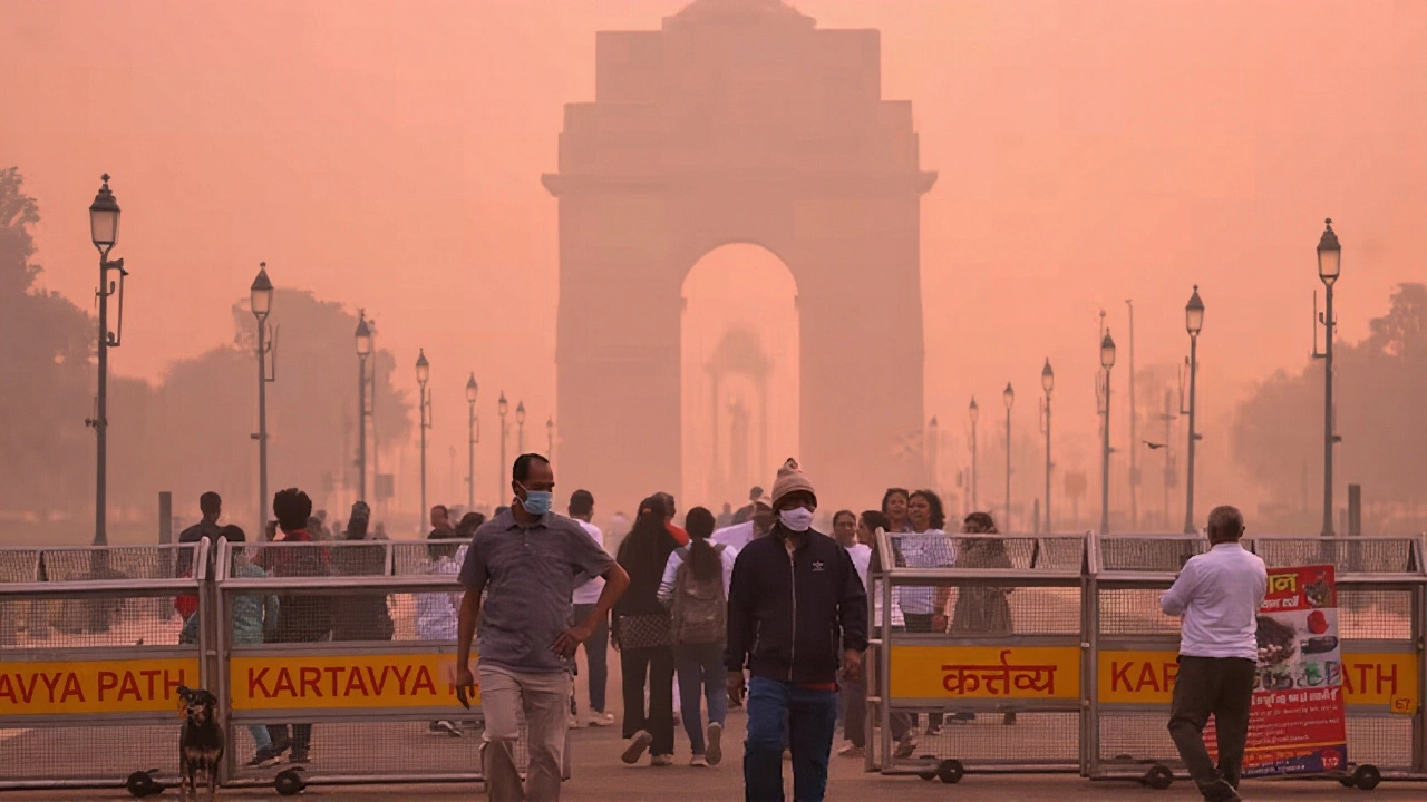
The IMD’s bulletin detailed a patchwork of rainfall risks. On October 27 and 28, thunderstorms with lightning and wind gusts up to 40 km/h were predicted over Tamil Nadu, Kerala, Mahe, Lakshadweep, and parts of Interior Karnataka and Rayalaseema. By October 29, the focus shifted inland: Chhattisgarh and Vidarbha braced for isolated very heavy rainfall, with some areas potentially seeing more than 120 mm in 24 hours. Odisha got the earliest and most severe warning—extremely heavy rain on the 27th, followed by persistent showers through the 30th. Meanwhile, Sub-Himalayan West Bengal and Sikkim faced a late surge, with the heaviest rain expected on the 31st.Even Delhi, typically dry this time of year, wasn’t spared. The IMD predicted one or two spells of very light rain or drizzle from the evening of the 27th through the morning of the 28th—a rare October event that could cause localized traffic disruptions and dampen outdoor events. Meanwhile, Yanam (a Puducherry enclave) and the Andaman & Nicobar Islands were also flagged for intermittent heavy showers.
Why the Uncertainty—and Why It Matters
The IMD’s forecast included a stark disclaimer, repeated in both Annexure II and III: "As the lead period increases, forecast accuracy decreases." That’s not just bureaucratic caution—it’s a reality of meteorology. Predicting rain five days out is like trying to guess the exact path of a leaf in a storm. Still, the patterns are clear enough to warrant action. Urban centers like Bhubaneswar, Nagpur, and Kolkata have aging drainage systems. A single day of 100+ mm rain can paralyze them. In hill towns like Gangtok or Kodaikanal, landslides become a real threat.What’s more, this isn’t just about inconvenience. In Chhattisgarh, where roads are often unpaved and rural hospitals lack backup generators, a heavy rain spell can cut off medical access. In Vidarbha, farmers are still recovering from last year’s drought—this rain could be a blessing or a disaster, depending on timing and intensity.
What the Numbers Tell Us
According to aggregated data from Weather25.com and Climate-data.org, October 2025 is shaping up to be a transitional month: average highs hover around 32–33°C, but nights are cooling fast—down to 17–20°C in northern regions. Delhi’s expected rainfall of 13 mm is modest, but unusual for late October. Nationally, total rainfall is projected at 106 mm for the month, spread unevenly. The IMD’s color-coded warning system—ORANGE for "heavy rainfall likely," RED for "extremely heavy rainfall with high risk"—isn’t fully explained in the bulletin, but local disaster management teams have been briefed. Action protocols include evacuations, school closures, and pre-positioning of rescue teams.Meanwhile, Lakshadweep and the Andaman & Nicobar Islands—already isolated by geography—face compounded risks. Ferry services may be suspended, and power outages could last days if transformers flood. The IMD’s district-wise GIS portal (mausam.imd.gov.in/responsive/districtWiseWarningGIS.php) is the only real-time source for hyperlocal alerts, and officials are urging residents to check it daily.
What Comes Next
By November 1, the system should weaken as a high-pressure ridge builds over northern India. But the pattern raises questions: Is this an anomaly, or the new normal? In recent years, India has seen more erratic rainfall after the monsoon—short bursts of extreme rain followed by prolonged dry spells. Experts point to warming in the Indian Ocean and shifting jet streams as contributing factors. The IMD has not yet issued a long-term climate analysis for October 2025, but meteorologists are watching closely.For now, the message is simple: Prepare. Keep emergency kits ready. Avoid low-lying areas. Monitor local alerts. And don’t rely on apps that say "sunny tomorrow"—when the IMD says RED, it’s not a suggestion. It’s a signal.
Frequently Asked Questions
Which areas are at highest risk of flooding during this period?
Odisha, particularly districts like Ganjam and Gajapati, and Vidarbha in Maharashtra—including Nagpur and Amravati—are at highest risk due to predicted very heavy rainfall on October 27 and 29. Urban centers like Kolkata and Bhubaneswar also face severe drainage stress. Rural areas in Chhattisgarh and Bihar are vulnerable due to poor infrastructure.
Why is the IMD’s forecast accuracy lower for longer timeframes?
Weather models become less reliable beyond 72 hours due to chaotic atmospheric interactions—tiny changes in humidity or wind speed can drastically alter outcomes. The IMD’s disclaimer reflects this scientific reality. While they can identify broad patterns (like a low-pressure system approaching), pinpointing exact rainfall totals or timing beyond five days is statistically uncertain. That’s why only ORANGE and RED warnings are actionable—green and yellow are advisory, not emergency.
How do ORANGE and RED warnings differ in practical terms?
ORANGE warnings mean "be prepared"—schools may close, emergency teams are on standby, and public advisories are issued. RED warnings mean "act now"—evacuations begin, transport is halted, and disaster response units deploy. For example, in Odisha during a RED alert, the State Disaster Response Force (SDRF) mobilizes boats and helicopters. In Delhi, a RED alert triggers waterlogging mitigation in 15 high-risk zones like Anand Vihar and Jahangirpuri.
Is this unusual weather for late October?
Yes. Typically, October is dry across most of India as the monsoon withdraws. While some rainfall in coastal regions is normal, heavy rain in Vidarbha, Chhattisgarh, and Sub-Himalayan West Bengal is uncommon this late. Climate scientists note a trend toward delayed monsoon withdrawal and lingering moisture in central India, possibly linked to Indian Ocean warming. This pattern has intensified since 2018.
What should travelers do if they’re visiting affected areas?
Avoid non-essential travel to Odisha, Chhattisgarh, and Sikkim between October 27–31. If already there, stay updated via IMD’s district portal and avoid riverbanks, hill roads, and low-lying streets. Flights to Lakshadweep and Andaman & Nicobar Islands may be canceled without notice. Always carry waterproof gear and emergency contacts.
Where can I get real-time updates for my district?
The only official source for hyperlocal alerts is the IMD’s district-wise GIS portal: mausam.imd.gov.in/responsive/districtWiseWarningGIS.php. It shows color-coded warnings by district, rainfall estimates, and thunderstorm probability. Local news channels and state disaster management websites also republish these alerts, but the IMD portal is the most accurate and updated in real time.